Traffic Light Actuation Without the Roadworks
Detect, classify, and drive your signal timing from a single sensor on the existing pole
Traffic light actuation (also called traffic signal actuation, demand-actuated signal control, or adaptive signal control) is the practice of adjusting signal timing in response to real-time detection of vehicles, cyclists, and pedestrians, instead of running a fixed timer. A sensor tells the controller who is waiting, where, and how many. The controller decides how long to hold or extend a phase.
The Problem with Legacy Detection Technologies
Cities looking for Traffic Light Actuation traditionally choose between one of four solutions, each with its own tradeoff:
LiDAR-based virtual loops from Flow Analytics by AGC are built to cover all of it from one sensor: presence, classification, and movement, in a single 3D read of the intersection.
Virtual Loops: Flexible Detection that Goes beyond Actuation
Flow Analytics by AGC installs LiDAR sensors on the existing traffic light pole. No cutting into the road or buried cable. The sensor builds a live 3D point cloud of the intersection, and detection zones are drawn on top of it in software: unlimited zones, resized or moved in minutes from a browser, no site visit needed.
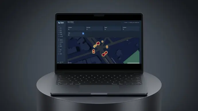
A physical loop only ever answers one question: is something here. But a virtual loop gives even more information. The same point cloud that actuates the signal also produces speed, heading, object class, trajectories, and near-miss data, so one deployment covers traffic light actuation and the movement analytics used for retiming, safety evaluation, and planning.
Benchmarked against physical inductive loops, virtual loop detections matched 99.83% of inductive loop events. Output connects to the controller over standard detector inputs or modern ITS protocols, on both legacy and current-generation controllers.
How It Works: Sense, Understand, Act
Virtual Loops vs. Other Detection Technologies
From Detection to Decisions
Traffic light actuation is the most immediate use of the data, but the same sensor deployment supports the layer of analysis cities actually plan around:
- Retiming signal plans based on measured turning movements and queue behavior, not counts taken once and assumed to hold.
- Identifying near-miss and conflict patterns before they become collision statistics, supporting Vision Zero programs with evidence rather than after-the-fact crash reports.
- Running before-and-after comparisons when a geometry change or new signal plan goes in.
- Feeding origin-destination and multimodal count data into wider mobility planning, without a second sensor deployment.
Recent Traffic Light Actuation Implementation
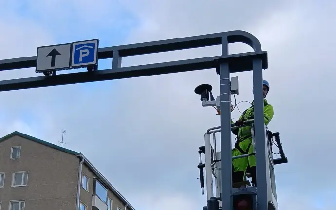
Flow Analytics deployed LiDAR-based virtual loops in Jyväskylä, Finland, as a direct alternative to inductive loops, actuating traffic signals without digging into the road. The deployment demonstrated stop-bar detection accuracy matching physical loops while adding movement data the previous system could not produce.
Read
Frequently Asked Questions
No new hardware is needed. Detection zones are software-defined, so they're redrawn from the existing sensor rather than requiring a site visit.
Typically one or two sensors per intersection depending on geometry, covering all approaches and the intersection body from the existing pole. Where more than one sensor is deployed, their data is fused into a single, unified view of the intersection, rather than each sensor detecting independently.
Anonymous 3D points only, no images, no faces, no plates.
Yes. LiDAR sensors emit their own light rather than relying on ambient light or a camera lens, so detection accuracy holds in darkness, rain, fog, and snow.
It can connect locally to the intersection's traffic signal controller or send data centrally to your Traffic Management Center for network-wide monitoring and control.
The solution works with standard traffic signal and ITS communication protocols, so it fits into existing controller and network setups without requiring a proprietary interface.
Why Traffic Light Actuation from Flow Analytics by AGC?

Privacy-first
Our solution never captures faces, license plates or personal data. It relies on anonymous 3D LiDAR points, making it fully GDPR-compliant and safe for public use.

Accurate and detailed
Movements are tracked down to the centimeter, enabling precise counts, classifications and trajectory analysis that manual methods and cameras cannot match.

Proven in real-world conditions
Designed for complex urban settings with heavy traffic, poor lighting or weather challenges, ensuring consistent results where other systems fail.

Actionable
Instead of raw feeds that need extra processing, we deliver insights in dashboards, reports and GIS formats that decision-makers can apply directly to planning, design and operations.