Virtual Loops.
Real Insights.
All the functionality of inductive loops, reimagined with LiDAR. No digging, no downtime, just precise data.
Contact us
The Problem with Inductive Loops
Conventional inductive loops are disruptive to install and costly to maintain. Every repair means cutting into the road surface and interrupting traffic. Even when they work perfectly, they provide only limited data such as basic counts and classifications, without context about what actually happens on the road. Cities need a flexible, high-precision alternative that delivers richer insights without infrastructure work.
Our Approach
Flow Analytics introduces virtual loops powered by LiDAR sensing.
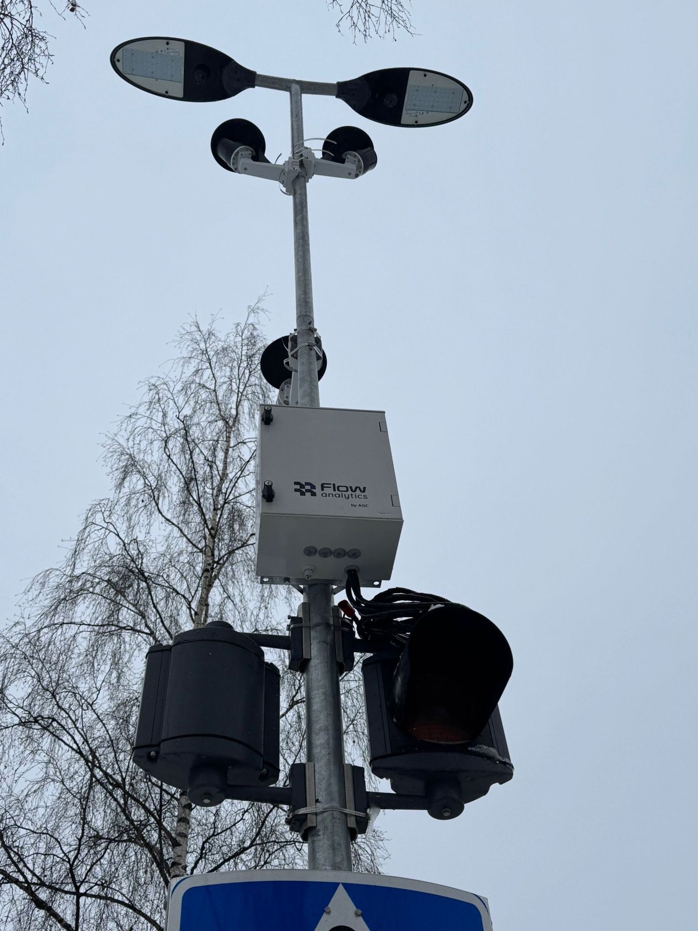
Out-of-ground sensing, installed directly on existing traffic lights, replaces traditional road-embedded loops with non-intrusive LiDAR detection. The system connects seamlessly to the intersection controller, delivering real-time data on vehicle movements, speeds, and interactions. It provides the same detection purpose as inductive loops while offering greater flexibility, richer insights, and effortless integration into existing traffic management infrastructure.
It tracks every vehicle and vulnerable road user in 3D space, providing counts, speeds, trajectories, and even near-miss events.
All detection zones and parameters are configurable through software, allowing layouts to evolve as intersection designs change. The system works with any controller, whether it belongs to an older generation or supports the latest ITS protocols. Our software adapts seamlessly to both, from mimicking traditional loops with more flexible and reliable detection zones to enabling full compatibility with advanced communication standards for next-generation traffic management.
Old Way vs. New Way
Key Features
Out of Ground. No Interruption. No Hassle
Installed directly on existing traffic lights, the system replaces in-road inductive loops with non-intrusive LiDAR sensing. No digging, no lane closures, and no disruption to traffic flow.
Adaptive Traffic Signal Strategy
Adjust your signal plans based on real mobility conditions. Prioritize pedestrians, cyclists, or public transport, or adapt signal logic dynamically by time of day or day of the week.
Flexible Zone Definition
Define unlimited virtual detection zones directly in the platform. All configurations are software-based and fully user-controlled, allowing instant adaptation to changing road layouts.
Rich Multidimensional Data
Go beyond simple presence detection. Access detailed information on speed, object type, direction, trajectories, and even identify vehicles blocking the intersection.
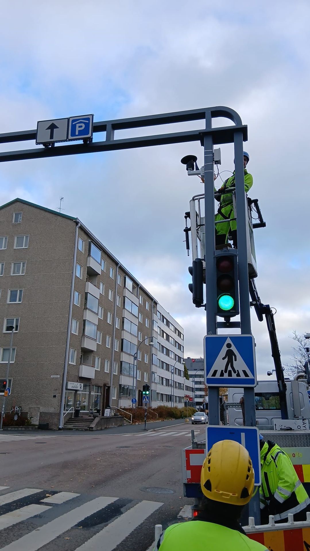
Recent Virtual Loops Implementation
Flow Analytics by AGC has recently deployed LiDAR-based virtual loops in Jyväskylä, Finland, supporting the city in modernizing its traffic management infrastructure. The system provides precise vehicle detection and movement data at intersections, helping optimize signal control without roadworks or disruption. It can be integrated into existing traffic management systems, allowing cities to enhance performance and data accuracy without replacing their current infrastructure. This project demonstrates how virtual loops offer a non-intrusive, flexible, and data-rich alternative to traditional inductive loops.