Parking Management
Smarter use of every parking space
Many cities and operators still rely on manual checks by parking wardens, ticket machines or cameras to monitor parking. These methods are costly, often inaccurate, and can create frustration for both operators and drivers. Flow Analytics by AGC offers a better alternative. With LiDAR-based, privacy-first analytics, we provide real-time visibility on parking occupancy, turnover and curbside activity, helping you make better use of limited space while keeping data protection in mind.
The Challenge in Parking
Limited parking space creates daily frustration. Drivers circle in search of free spots, adding congestion and emissions, while illegal or long-stay parking disrupts traffic and reduces turnover. Without accurate occupancy and dwell-time data, operators lose revenue and cities lose control of their curbside.
How It Works
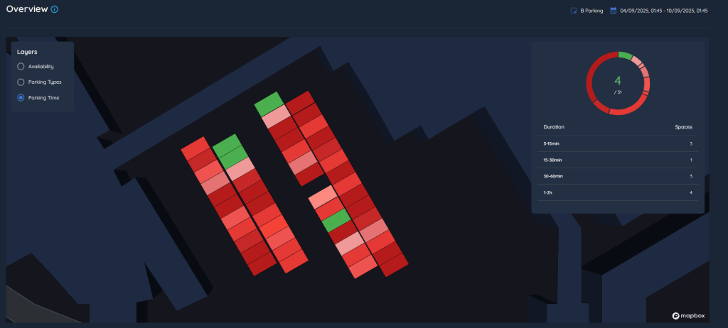
Real-time availability
The platform shows exactly which bays, levels or street zones are free at any given moment, making it easier to guide drivers and reduce unnecessary circulation.

Turnover and dwell times
Every parking event is measured from arrival to departure, so operators can see how long vehicles stay, identify overstays and understand how efficiently spaces are being used.
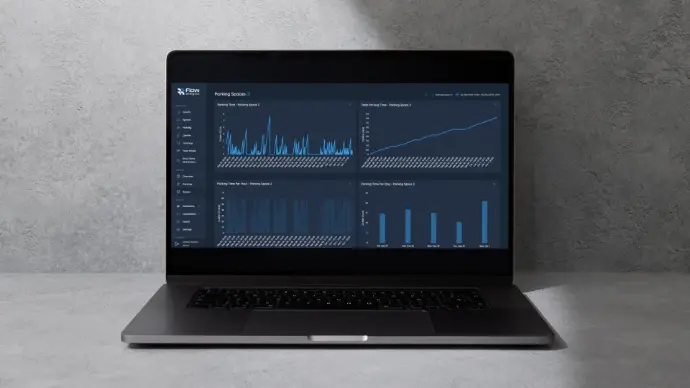
Patterns over time
Daily, weekly and seasonal demand curves are automatically generated, providing clear evidence for policy adjustments, pricing models or long-term planning.
From Insights to Action
Parking analytics support smarter policies and better user experience:
- Provide live guidance to reduce circling and congestion.
- Improve enforcement with accurate overstay detection.
- Adjust pricing or regulations based on true demand.
- Plan future facilities with evidence of actual usage.

Recent Parking Management Implementation
Flow Analytics by AGC was deployed at the King’s Lynn Hospital (UK) parking area in collaboration with Mobilityways. The system provided real-time insights into occupancy, turnover, and dwell times across the carsharing parking zones. This allowed the site operators to understand how spaces were used throughout the day and to identify areas with persistent congestion or underuse.
Why Parking Management from Flow Analytics by AGC?

Privacy-first
Our solution never captures faces, license plates or personal data. It relies on anonymous 3D LiDAR points, making it fully GDPR-compliant and safe for public use.

Accurate and detailed
Movements are tracked down to the centimeter, enabling precise counts, classifications and trajectory analysis that manual methods and cameras cannot match.

Proven in real-world conditions
Designed for complex urban settings with heavy traffic, poor lighting or weather challenges, ensuring consistent results where other systems fail.

Actionable
Instead of raw feeds that need extra processing, we deliver insights in dashboards, reports and GIS formats that decision-makers can apply directly to planning, design and operations.