Liikennevalojen ohjaus ilman katutöitä
Tunnista, luokittele ja ohjaa liikennevalojen ajoitusta yhdellä olemassa olevaan pylvääseen asennetulla sensorilla
Liikennevalojen liikenneohjaus (tunnetaan myös nimillä liikennevalojen kysyntäohjaus, tarveohjattu liikennevalo-ohjaus tai adaptiivinen liikennevalo-ohjaus) tarkoittaa liikennevalojen ajoituksen säätämistä ajoneuvojen, pyöräilijöiden ja jalankulkijoiden reaaliaikaisen havaitsemisen perusteella kiinteän ajastuksen sijaan. Sensori kertoo liikennevalo-ohjaimelle, ketkä odottavat, missä he ovat ja kuinka paljon liikennettä on. Ohjain päättää tämän tiedon perusteella, kuinka pitkään valovaihetta pidetään yllä tai jatketaan.
Perinteisten tunnistusteknologioiden haasteet
Liikennevalojen liikenneohjausta toteuttavat kaupungit ovat perinteisesti valinneet yhden neljästä ratkaisusta, joista jokaisella on omat kompromissinsa:
Flow Analytics by AGC:n LiDAR-pohjaiset virtuaalisilmukat kattavat kaiken yhdellä sensorilla: läsnäolon, luokittelun ja liikkeen yhdestä risteyksen 3D-mittauksesta.
Virtuaalisilmukat: joustavaa tunnistusta liikennevalo-ohjausta laajemmin
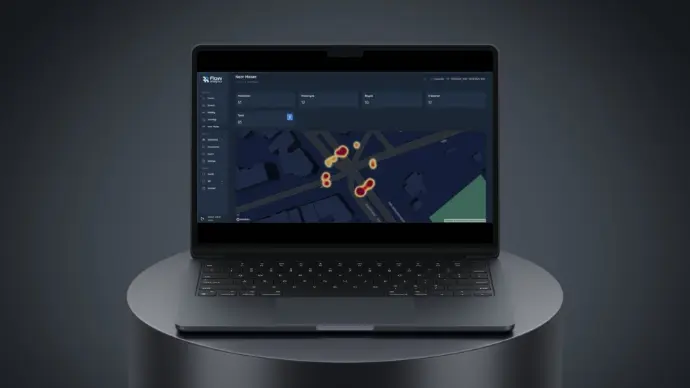
Flow Analytics by AGC asentaa LiDAR-sensorit olemassa oleviin liikennevalopylväisiin. Tienpintaa ei tarvitse avata eikä kaapeleita asentaa maan alle. Sensori muodostaa risteyksestä reaaliaikaisen 3D-pistepilven, jonka päälle tunnistusalueet määritellään ohjelmistossa. Alueita voidaan luoda rajattomasti, ja niiden kokoa tai sijaintia voidaan muuttaa muutamassa minuutissa selaimen kautta ilman käyntiä paikan päällä.
Fyysinen silmukka vastaa käytännössä vain yhteen kysymykseen: onko tässä jotain. Virtuaalisilmukka tuottaa huomattavasti enemmän tietoa. Sama pistepilvi, jota käytetään liikennevalojen ohjaukseen, antaa tietoa myös nopeudesta, kulkusuunnasta, kohdeluokasta, liikeradoista ja läheltä piti -tilanteista. Näin yksi ja sama järjestelmä tukee sekä liikennevalo-ohjausta että liikkumisen analytiikkaa, jota voidaan hyödyntää ajoitusten optimoinnissa, liikenneturvallisuuden arvioinnissa ja suunnittelussa.
Fyysisiin induktiosilmukoihin verrattuna virtuaalisilmukoiden tunnistukset vastasivat 99,83-prosenttisesti induktiosilmukoiden havaintoja. Järjestelmän tuottama tieto voidaan välittää liikennevalo-ohjaimelle joko tavallisten ilmaisinliitäntöjen tai nykyaikaisten ITS-protokollien kautta, ja ratkaisu toimii sekä vanhempien että uusimman sukupolven ohjainten kanssa.
Näin se toimii: havaitse, ymmärrä, ohjaa
Virtuaalisilmukat verrattuna muihin tunnistusteknologioihin
Havainnoista päätöksentekoon
Liikennevalo-ohjaus on datan välittömin käyttökohde, mutta sama sensorijärjestelmä tukee myös laajempaa analytiikkaa, jonka pohjalta kaupungit tekevät liikenteen suunnittelua:
- Liikennevalojen ajoitusten optimointi mitattujen kääntymisliikkeiden ja jonojen käyttäytymisen perusteella sen sijaan, että tukeuduttaisiin vain kerran tehtyihin liikennelaskentoihin.
- Läheltä piti -tilanteiden ja konfliktimallien tunnistaminen ennen kuin ne näkyvät onnettomuustilastoissa. Tämä tukee Vision Zero -ohjelmia ennakoivalla datalla pelkkien jälkikäteen laadittujen onnettomuusraporttien sijaan.
- Ennen–jälkeen-vertailujen tekeminen, kun risteyksen geometriaa muutetaan tai uusi liikennevalojen ajoitussuunnitelma otetaan käyttöön.
- Lähtö–määränpää-tiedon ja eri kulkumuotojen liikennemäärien hyödyntäminen laajemmassa liikkumisen suunnittelussa ilman erillistä toista sensoriasennusta.
Viimeaikainen liikennevalo-ohjauksen käyttöönotto
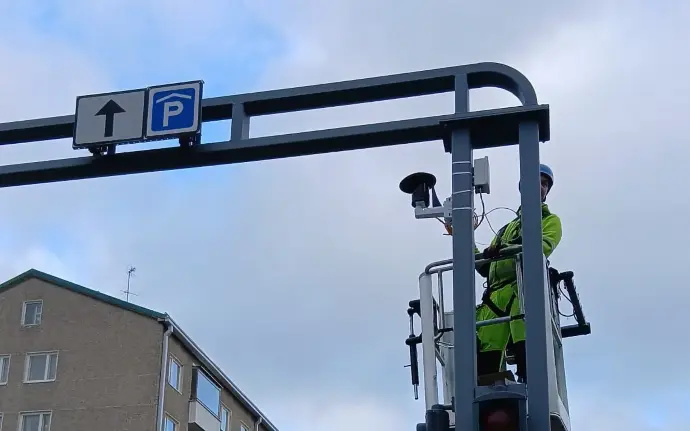
Flow Analytics otti Jyväskylässä käyttöön LiDAR-pohjaiset virtuaalisilmukat suorana vaihtoehtona induktiosilmukoille. Ratkaisun avulla liikennevaloja voidaan ohjata ilman tienpinnan kaivamista. Käyttöönotossa pysäytysviivan kohdalla tapahtuvan tunnistuksen tarkkuus vastasi fyysisiä silmukoita, mutta samalla järjestelmä tuotti liikkumisdataa, jota aiempi ratkaisu ei pystynyt tarjoamaan.
Usein kysytyt kysymykset
Uutta laitteistoa ei tarvita. Tunnistusalueet määritellään ohjelmistossa, joten ne voidaan piirtää uudelleen olemassa olevan sensorin datan perusteella ilman käyntiä paikan päällä.
Tyypillisesti yksi tai kaksi sensoria risteystä kohden riittää risteyksen geometriasta riippuen. Olemassa oleviin pylväisiin asennettuna ne kattavat kaikki lähestymissuunnat sekä itse risteysalueen. Jos sensoreita on useampi kuin yksi, niiden data yhdistetään yhdeksi yhtenäiseksi näkymäksi risteyksestä sen sijaan, että kukin sensori toimisi erillisenä tunnistusjärjestelmänä.
Vain anonyymejä 3D-pisteitä – ei kuvia, kasvoja tai rekisterikilpiä.
Kyllä. LiDAR-sensorit lähettävät oman valonsa eivätkä ole riippuvaisia ympäristön valaistuksesta tai kameran linssistä. Siksi tunnistustarkkuus säilyy myös pimeässä, sateessa, sumussa ja lumessa.
Järjestelmä voidaan liittää paikallisesti suoraan risteyksen liikennevalo-ohjaimeen tai lähettää data keskitetysti liikenteenhallintakeskukseen koko verkon seurantaa ja ohjausta varten.
Ratkaisu tukee liikennevalojärjestelmien ja ITS-järjestelmien standardeja tiedonsiirtoprotokollia, joten se voidaan integroida olemassa oleviin ohjain- ja verkkoratkaisuihin ilman valmistajakohtaista rajapintaa.
Miksi valita Flow Analytics by AGC:n liikennevalo-ohjaus?

Tietosuoja etusijalla
Ratkaisumme ei tallenna kasvoja, rekisterikilpiä tai henkilötietoja. Se perustuu anonyymeihin 3D-LiDAR-pisteisiin, joten ratkaisu on täysin GDPR:n mukainen ja soveltuu turvallisesti julkisiin ympäristöihin.

Tarkka ja yksityiskohtainen
Liikkeet seurataan senttimetrin tarkkuudella, mikä mahdollistaa täsmälliset laskennat, luokittelut ja liikerata-analyysit tasolla, johon manuaaliset menetelmät tai kamerat eivät yllä.

Toimivaksi todistettu todellisissa olosuhteissa
Suunniteltu vaativiin kaupunkiympäristöihin, joissa liikenne on vilkasta, valaistus heikko tai sääolosuhteet haastavat. Ratkaisu tuottaa tasalaatuisia tuloksia myös olosuhteissa, joissa muut järjestelmät eivät toimi luotettavasti.

Toimintaa ohjaava
Raakadatan sijaan tarjoamme suoraan hyödynnettävää tietoa dashboardeissa, raporteissa ja GIS-muodoissa, jotta päätöksentekijät voivat käyttää sitä suoraan suunnittelussa, liikennejärjestelyissä ja operatiivisessa toiminnassa.