
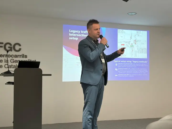
Last week, Flow Analytics by AGC joined the Transport Innovation Alliance City Leadership Forum in Barcelona, where our General Manager, Robin Lefrant, presented a real-world case from Oulu (Finland) alongside Jani Koppelo, Traffic Engineer at the City of Oulu.
Their session, How New Approaches to Traffic Management Can Deliver Policy Goals, examined how cities can improve safety, efficiency, and sustainability at intersections while reducing reliance on legacy infrastructure.
Intersections Remain One of the Biggest Urban Bottlenecks
Many junctions still underperform, generating unnecessary stop-time, delays, and emissions that undermine both traffic flow and the wider urban mobility experience. As congestion continues to strain city networks, intersections remain one of the most visible and addressable weak points.
While OEM-led V2X deployment may still take years to reach scale, roadside infrastructure already offers cities a practical near-term route to smarter, more responsive traffic management. According to SWARCO, adaptive AI-based traffic control has shown the potential to reduce average delay by up to 47%, stops by up to 39%, and CO₂ emissions by up to 22% in a disrupted routing scenario.
For cities, improving intersection intelligence is not just a technical upgrade. It is a practical step toward broader mobility, climate, and safety goals.
A Real-Life Example from Oulu
Jani Koppelo shared how the city is already using Flow Analytics’ LiDAR-based virtual loop approach in practice.
In Oulu, two LiDAR sensors cover the functions of all inductive loops and radars across an entire intersection. That matters because it shows how above-ground sensing can replace what has traditionally been a fragmented, hardware-heavy setup. Instead of relying on multiple point solutions embedded in or installed around the roadway, the city can use a more streamlined approach to capture a broader and more unified view of intersection activity.
The benefit is not only simpler infrastructure. LiDAR-based detection also gives the city a richer understanding of what is happening on the road, including vehicle movements, queue formation, speed behaviour, and interactions between different road users. For cities looking to modernise traffic management, this makes a strong case for moving beyond legacy detection methods toward infrastructure that is easier to manage and more capable in daily operation.
Compared with traditional inductive loop methods, the LiDAR-based approach can be two to three times more cost-efficient. The difference becomes even more apparent over time. When asphalt is renewed, typically every 5 to 20 years depending on the road type, inductive loops often need to be reinstalled, adding another €15,000 to €20,000 in costs. LiDAR sensors, installed above ground, do not need to be replaced during asphalt renewal.
In many cases, a single LiDAR unit can provide full intersection coverage, reducing upfront investment while avoiding future replacement costs linked to roadworks.
This flexibility is supported by performance data. In a recent benchmarking study, Flow Analytics compared its virtual loop detection technology with traditional inductive loop sensors. The results showed 99.83% inductive-loop event matching over 10 days, demonstrating that virtual loops can provide reliable detection for traffic light actuation while also enabling more advanced analytics.
More than Actuation
One of the clearest messages from the session was that the value of LiDAR-based virtual loops extends well beyond traffic light actuation. Replacing physical loops with virtual loops is like moving from a landline to a smartphone. The core function remains, but the capabilities expand significantly.
As Robin Lefrant put it:
“Actuation is only the beginning. The same data that moves traffic today can help cities plan, monitor, and improve safety tomorrow.”
Traditional inductive loops can detect vehicle presence, but the data they provide is limited. LiDAR-based virtual loops can deliver a much broader set of insights, including presence detection, speed measurement, turning movements, queue analysis, point-to-point tracking, trajectories, near-miss detection, and road-user interactions.
That allows cities to use the same infrastructure not only for traffic control, but also for safety analysis, planning, monitoring, and longer-term mobility improvement.
Helping Cities Move beyond Fixed Infrastructure
The Oulu case shows how cities can move beyond fixed, road-embedded infrastructure toward traffic management that is more flexible, more responsive, and more data-rich.
With privacy-first LiDAR and AI analytics, Flow Analytics by AGC helps cities strengthen intersection intelligence and better understand how different road users move and interact in real time.
For cities looking to reduce delays, improve safety, lower emissions, and make better use of existing infrastructure, virtual loops offer a practical and scalable path forward.
The discussion in Barcelona reinforced a clear point: cities do not need to wait for future mobility systems to begin improving intersections. The tools are already available, and Oulu shows what is possible when they are applied in practice.